|
Water and Land Working Party Monday 27 September 2021 at 1:00pm
|
|
|
|
|


|
Water and Land Working Party Monday 27 September 2021 at 1:00pm
|
|
|
|
|
Water and Land Working Party
27 September 2021
Water and Land Working Party Agenda
Meeting to be held in the Council Chamber
36 Water Street, Whangārei
on Monday 27 September 2021, commencing at 1:00pm
Please note: working parties and working groups carry NO formal decision-making delegations from council. The purpose of the working party/group is to carry out preparatory work and discussions prior to taking matters to the full council for formal consideration and decision-making. Working party/group meetings are open to the public to attend (unless there are specific grounds under LGOIMA for the public to be excluded).
MEMBERSHIP OF THE Water and Land Working Party
Chairperson, Councillor Justin Blaikie
|
Councillor Jack Craw |
Councillor Amy Macdonald |
Councillor Marty Robinson |
|
Councillor Joce Yeoman |
Ex-Officio Penny Smart |
TTMAC Representative Georgina Connelly |
|
TTMAC Representative Alan Riwaka |
TTMAC Representative Janelle Beazley |
TTMAC Representative Mira Norris |
|
|
|
|
KARAKIA
RĪMITI (ITEM) Page
1.0 Ngā Mahi Whakapai/Housekeeping
2.0 Ngā Whakapahā/apologies
3.0 Ngā Whakapuakanga/declarations of conflicts of interest
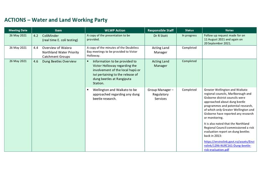
4.1 Receipt of Action Sheet 2
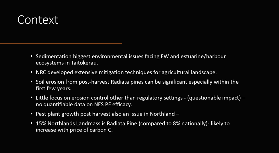
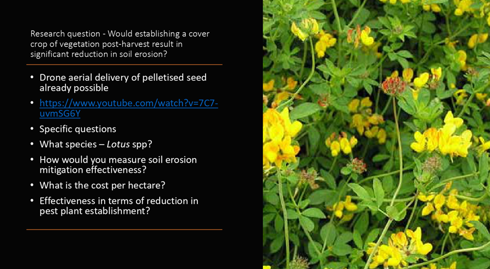
4.2 Aerial Application of Seed using Drones for Erosion Control Mitigation
(presenter Justin Blaikie)
Attachment 1 Utilisation of Pelletised Seed 2
4.3 Overview of Water Resources Investigation Projects in Northland (Aupōuri and Poutō) 2
4.4 Coastal Ecological Monitoring 2
Water and Land Working Party item: 4.1
27 September 2021
|
TITLE: |
Receipt of Action Sheet |
|
From: |
Kathryn Pabirowski, Regulatory Services Admin/PA |
|
Authorised by Group Manager/s: |
Colin Dall, Pou Whakaritenga - Group Manager Regulatory Services, on 21 September 2021 |
Whakarāpopototanga / Executive summary
The purpose of this report is to enable the meeting to receive the current action sheet.
That the action sheet be received.
Attachments/Ngā tapirihanga
Attachment 1: Actions
- Water and Land Working Party ⇩ ![]()
27 September 2021
|
TITLE: |
Overview of Water Resources Investigation Projects in Northland (Aupōuri and Poutō) |
|
From: |
Colin Dall, Pou Whakaritenga - Group Manager Regulatory Services |
|
Authorised by Group Manager/s: |
Colin Dall, Pou Whakaritenga - Group Manager Regulatory Services, on 20 September 2021 |
Whakarāpopototanga / Executive summary
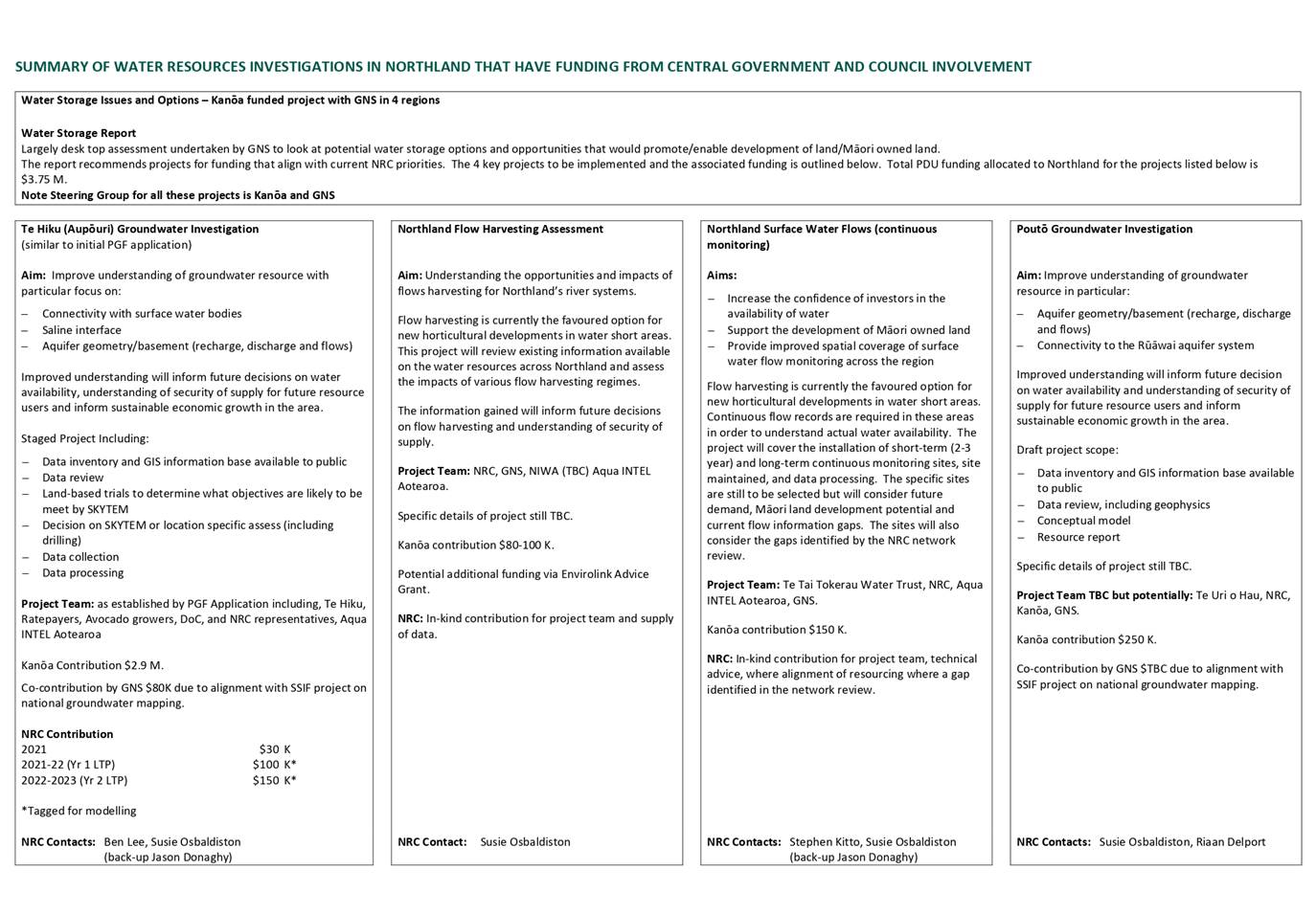
There has been or will be significant recent investment (several millions of dollars) by Central Government agencies into investigation of water resources in parts of Northland, particularly in the Aupōuri and Poutō areas. This report provides an overview of the investigations that have Central Government funding which the Northland Regional Council is involved in.
There are six projects in various stages, with most being in their early stage:
1. Te Hiku (Aupōuri) Groundwater Investigation.
2. Northland Flow Harvesting Assessment.
3. Northland Surface Water Flows (continuous monitoring).
4. Poutō Groundwater Investigation.
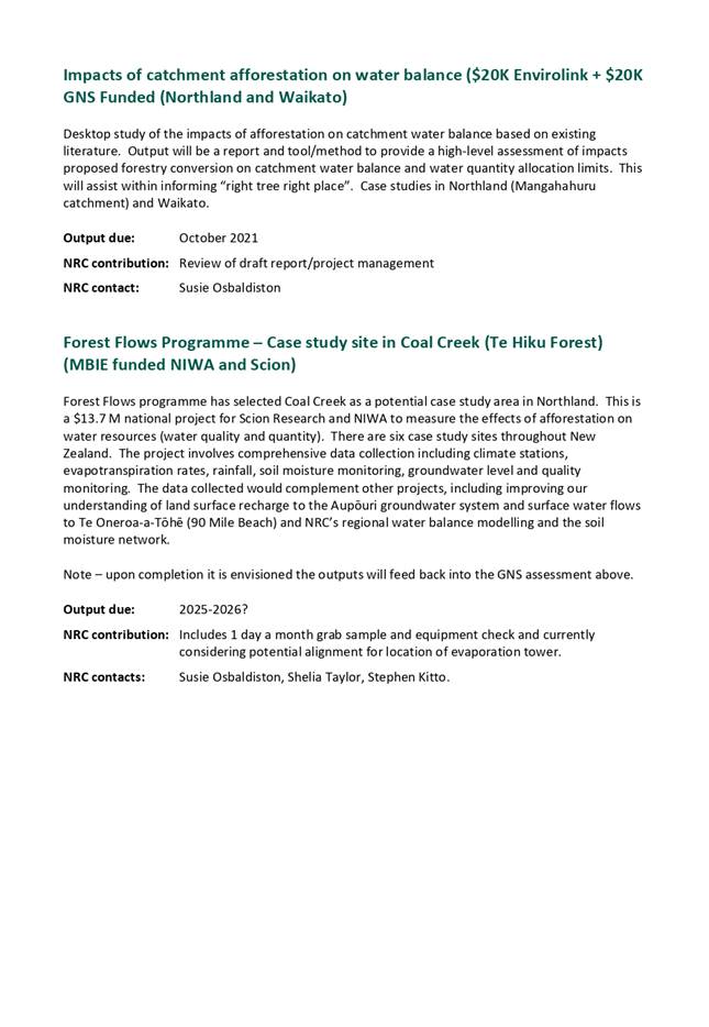
5. Impacts of catchment afforestation on water balance.
6. Forest Flows Programme – Case study site in Coal Creek (Te Hiku Forest).
A summary of the scope and some details of each of these projects is given in the attachment.
Background/Tuhinga
Not relevant.
Attachment 1: Summary
of Water Resources Investigations ⇩ ![]()
Water and Land Working Party item: 4.4
27 September 2021
|
TITLE: |
Coastal Ecological Monitoring |
|
From: |
Richard Griffiths, Resource Scientist Coastal |
|
Authorised by Group Manager/s: |
Colin Dall, Pou Whakaritenga - Group Manager Regulatory Services, on 20 September 2021 |
Whakarāpopototanga / Executive summary
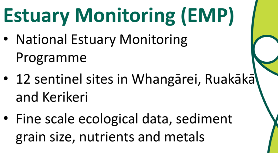
In 2008, the Northland Regional Council (Council) implemented the National Estuary Monitoring Protocol. The protocol was developed by the Cawthron Institute for use by regional councils and has been widely adopted by councils throughout the country. The monitoring programme was implemented to assess the health of representative intertidal sites and provide baseline data, which could be used to track changes in the health of these sites over time. The programme involves sampling ecological communities, nutrient and metal concentrations, and the physical properties of the sediment. This enables us to relate patterns in the ecological communities to the sediment properties. The council has nine sentinel sites in the Whangārei Harbour, Ruakākā Estuary and Kerikeri Inlet. These sites are sampled every two years.
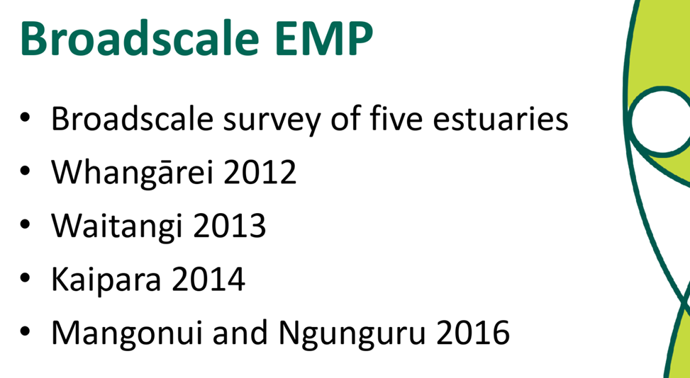
The council subsequently adapted the survey methods in the Estuary Monitoring Protocol to undertake broadscale ecological surveys in estuaries, which had been identified as ‘priority catchments’ by the council. The council surveyed the Whangārei Harbour in 2012, Waitangi Estuary in 2013, Kaipara Harbour in 2014, and the Mangonui Harbour and Ngunguru Estuary in 2016. The purpose of these surveys was to provide baseline data to track changes in the ecological status of these estuaries over time. Results from these surveys are available on the council’s website: https://www.nrc.govt.nz/resource-library-summary/research-and-reports/coastal/
These estuaries are scheduled to be re-surveyed every 10 years.
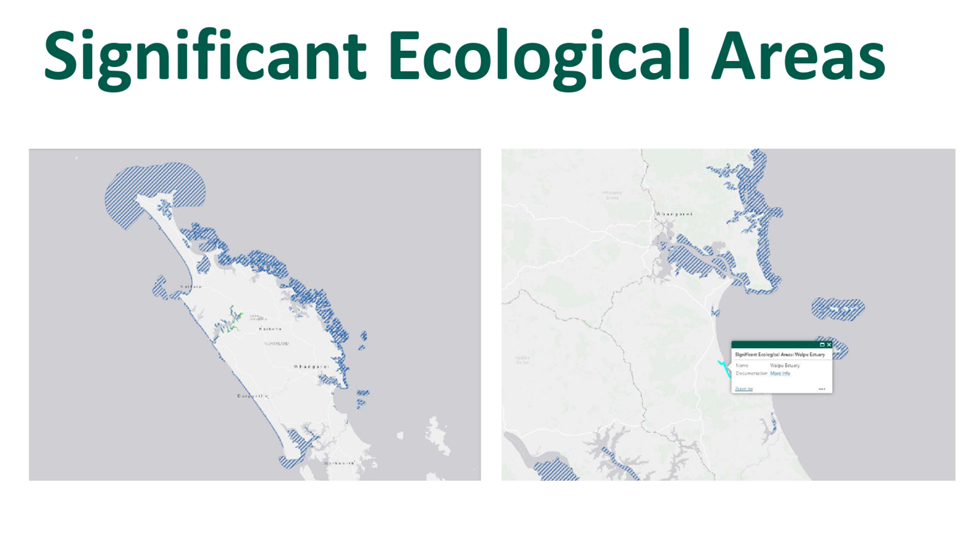
Significant Ecological Areas (SEAs)
The Proposed Regional Plan for Northland (PRP) identified and mapped Significant Ecological Areas (SEAs) in Northland’s Coastal Marine Area: https://nrcgis.maps.arcgis.com/apps/webappviewer/index.html?id=31f5c66ea0074f59908767452bcbc60d
The council has recently initiated ‘pilot’ ecological assessments of three SEAs to provide baseline data so that in the future we can assess whether the policies and rules in the PRP have been effective at maintaining, if not improving, the ecological values identified in these SEAs. Specifically, the data will help us to assess the effectiveness of Policy D.2.18 (managing adverse effects on indigenous biodiversity).
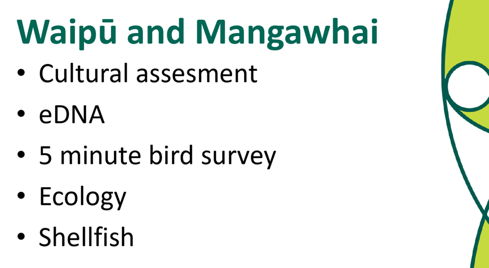
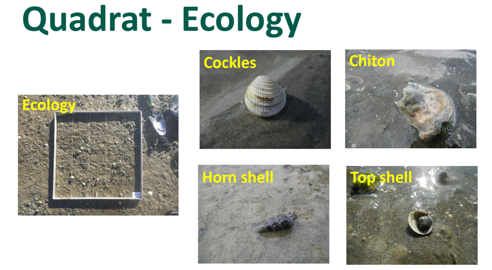
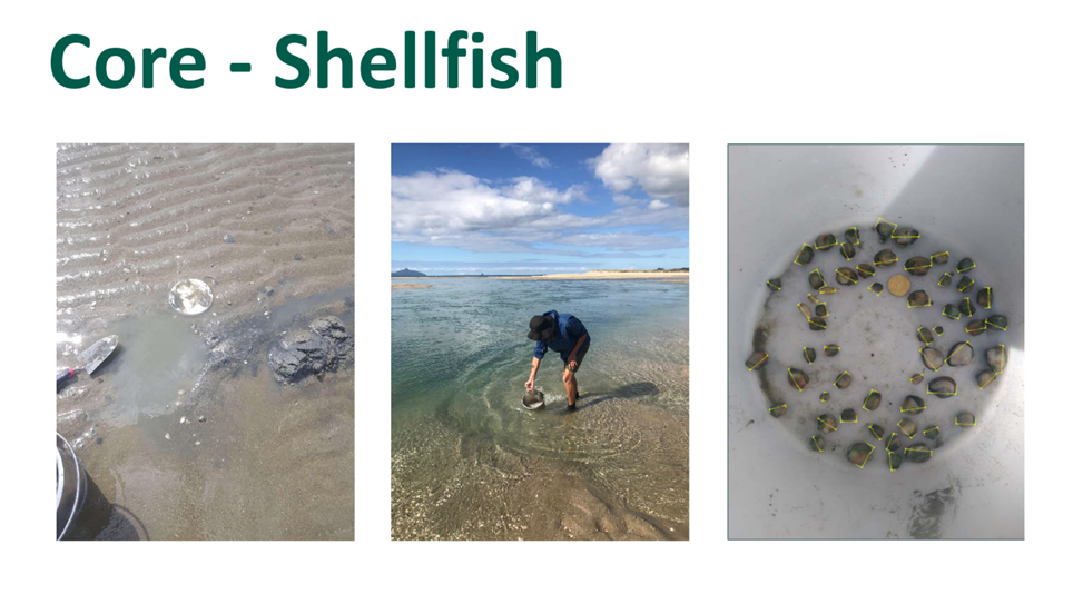
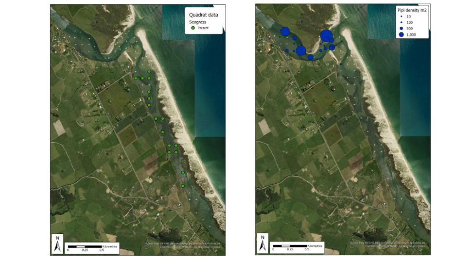
Waipū and Mangawhai
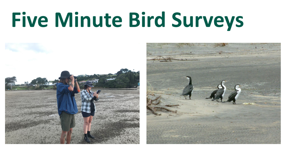
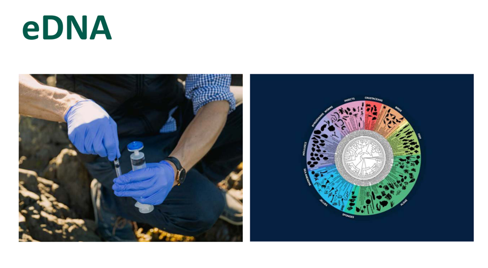
The council has partnered with Patuharakeke to assess the health of the Waipū Estuary and with Te Uri o Hau to assess the Mangawhai Harbour. These baseline assessments included a cultural health assessment, quadrat surveys of the ecology, shellfish core sampling, five-minute bird counts and eDNA sampling. Analysis of the data is being undertaken to identify and map the distribution of ecological features including seagrass and shellfish beds.
Ipipiri Platform – Eastern Bay of Islands
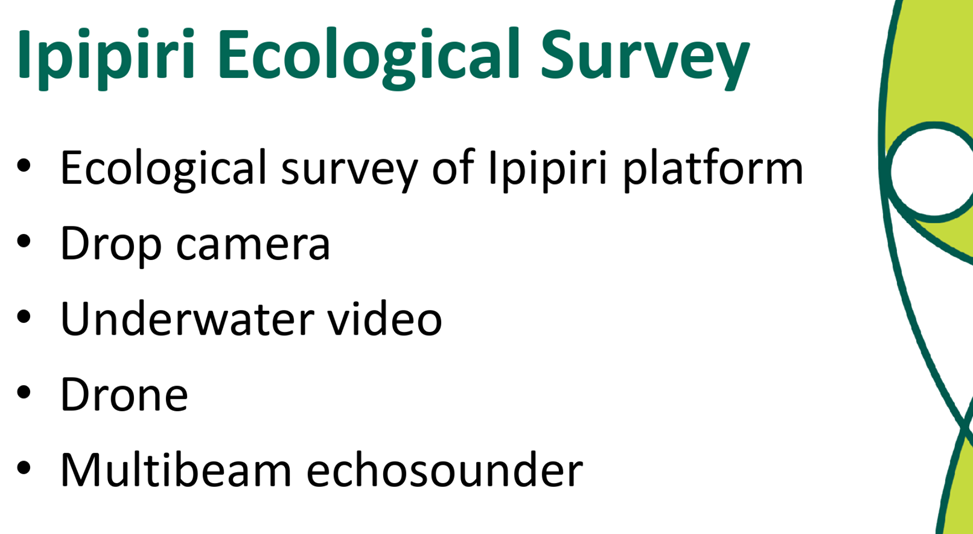
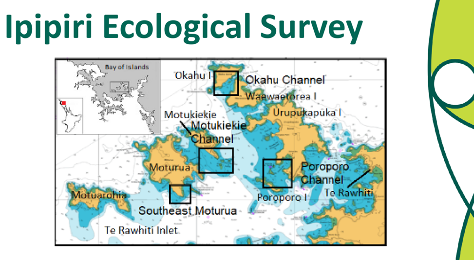
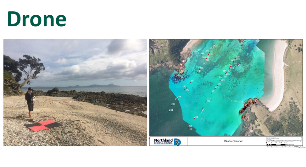
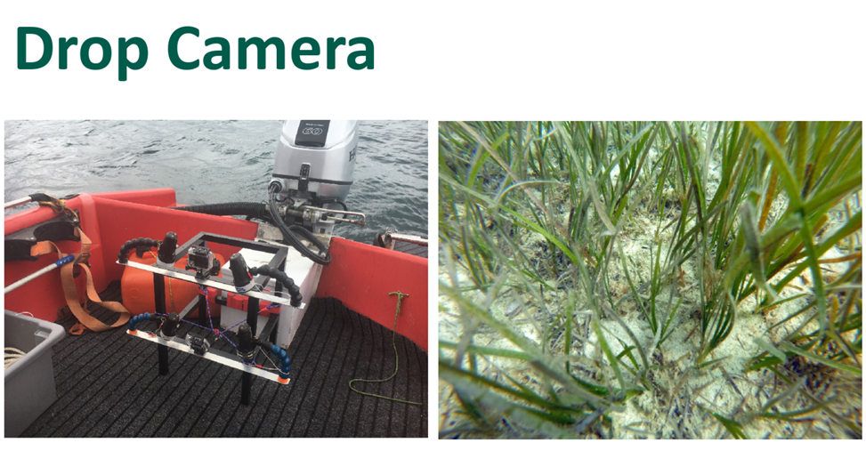
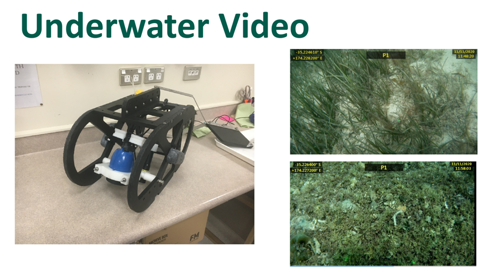
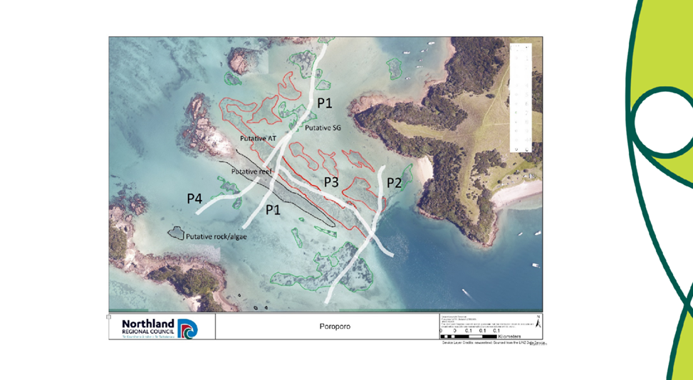
The council has supported a project developed by local researchers, Ngāti Kuta and NIWA, to survey the ecology of the semi-sheltered waters located between the central islands of the eastern Bay of Islands and the Rāwhiti channel.
A drop camera, under-water video, drone, and a multibeam echosounder were used to survey the area. Extensive beds of turf algae have been identified around the islands, extending to depths of 12 metres. Analysis of the images is ongoing, and a habitat map of the area will be created.
Future Direction
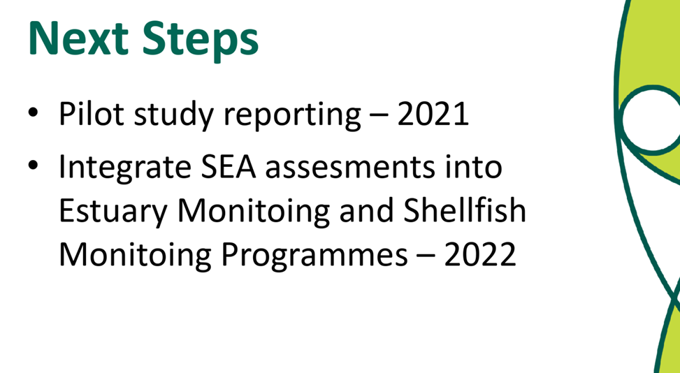
The pilot projects in the Waipū Estuary and Mangawhai have identified several effective low-cost methods to survey intertidal SEAs. The collaboration with Patuharakeke and Te Uri o Hau have also provided an opportunity to share knowledge and understanding of the ecological and cultural values of the estuaries and to incorporate an assessment of cultural health. Council staff intend to integrate some of the assessment methods with the existing Estuary Monitoring and Shellfish Monitoring Programmes to enable a broader assessment of ecological health.
The councils’ involvement with the survey of the Eastern Bay of Islands SEA has provided the council with experience of subtidal survey methods. The drop camera appeared to be a relatively low-cost assessment tool available to the council. The drone was also able to provide high quality images of ecological features on the seabed in shallow, sheltered water, with good water quality. However, subtidal surveys are more complex than intertidal surveys and will require the use of a vessel and more specialised equipment.
Not applicable – information only.
Background/Tuhinga
Not relevant.
Attachment 1: Coastal
Ecological Monitoring ⇩ ![]()